Skip to search
Skip to main content
Digital Commonwealth
Sign Up / Log In
Search for
Search
Search
Search
Basic
Advanced
Explore
Map
Collections
Institutions
Formats
For Educators
Primary Source Sets
Lesson Plans
Using Primary Sources
Searching Digital Commonwealth
For Institutions
Join Digital Commonwealth
Conferences, Trainings, & Events
How to Contribute Collections
Digitization Services
Board & Committees
Frequently Asked Questions
About
About Digital Commonwealth
News & Announcements
Copyright & Terms of Use
Harmful Content Statement
Partners
API
Contact Us
Boston Public Library
Norman B. Leventhal Map Center Collection
Assiniboia
Assiniboia
×
Item Information
Title:
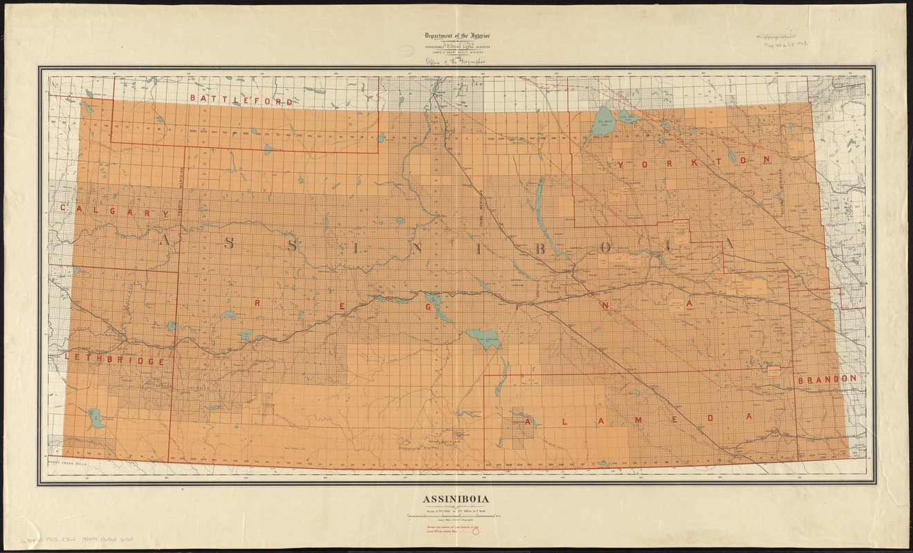
Assiniboia
Creator:
Canada. Department of the Interior
Name on Item:
James White, F.R.G.S., geographer ; Department of the Interior.
Date:
1903
Format:
Maps/Atlases
Location:
Boston Public Library
Norman B. Leventhal Map Center
Collection (local):
Norman B. Leventhal Map Center Collection
Subjects:
Assiniboia, District of (Sask. and Alta.)--Maps
Saskatchewan--Administrative and political divisions--Maps
Alberta--Administrative and political divisions--Maps
Places:
Canada
>
Province of Saskatchewan
(province)
Extent:
1 map : col. ; 47 x 97 cm
Permalink:
https://ark.digitalcommonwealth.org/ark:/50959/4m90ff70x
Terms of Use:
No known copyright restrictions.
No known restrictions on use.
Publisher:
[Ottawa] : Canada, Dept. of the Interior
Scale:
Scale 1:792,000 or 12 1/2 miles to 1 inch
Language:
English
Identifier:
06_01_011596
Call #:
G3490 1903 .C362
Barcode:
39999065686154
show more...
View MODS XML
More Like This
Saskatchewan
The 100th anniversary map of Abraham Lincoln's visit to ...
1630 shoreline
1879. Progress map of the U.S. Geographical Surveys west of the ...
Find More Like This >>
Tools
Share
Facebook
Pinterest
X
Reddit
Tumblr
Email
Copy link
Add to Folder
Questions/Comments
Cite This Item
IIIF Manifest
Downloads
Primary (full resolution, uncompressed)
(TIF, 101 MB)
Large (full resolution)
(JPEG, 8.5 MB)
Medium
(JPEG, 346 KB)