Skip to search
Skip to main content
Digital Commonwealth
Sign Up / Log In
Search for
Search
Search
Search
Basic
Advanced
Explore
Map
Collections
Institutions
Formats
For Educators
Primary Source Sets
Lesson Plans
Using Primary Sources
Searching Digital Commonwealth
For Institutions
Join Digital Commonwealth
Conferences, Trainings, & Events
How to Contribute Collections
Digitization Services
Board & Committees
Frequently Asked Questions
About
About Digital Commonwealth
News & Announcements
Copyright & Terms of Use
Harmful Content Statement
Partners
API
Contact Us
Boston Public Library
Norman B. Leventhal Map Center Collection
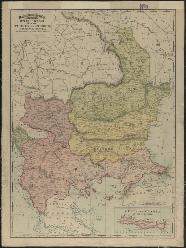
Rand, McNally & Co.'s indexed atlas of the world map of Turkey in Europe, Roumania, Servia, Bulgaria, and Montenegro
Rand, McNally & Co.s indexed atlas of the world map of Turkey in Europe, Roumania, Servia, Bulgaria, and Montenegro
×
Item Information
Title:
Rand, McNally & Co.'s indexed atlas of the world map of Turkey in Europe, Roumania, Servia, Bulgaria, and Montenegro
Title (alt.):
Indexed atlas of the world map of Turkey in Europe
Map of Turkey in Europe, Roumania, Servia, Bulgaria and Montenegro
Publisher:
Rand McNally and Company
Date:
1892
Format:
Maps/Atlases
Location:
Boston Public Library
Norman B. Leventhal Map Center
Collection (local):
Norman B. Leventhal Map Center Collection
Subjects:
Turkey--Maps
Balkan Peninsula--Maps
Places:
Turkey
Balkan Peninsula
(area)
Extent:
1 map : color ; 66 x 48 cm
Permalink:
https://ark.digitalcommonwealth.org/ark:/50959/4m90fn951
Terms of Use:
No known copyright restrictions.
No known restrictions on use.
Publisher:
[Chicago, Illinois] : Rand, McNally & Co.
Scale:
Scale approximately 1:1,930,000
Language:
English
Notes:
Relief shown by hachures.
Inset: Crete or Candia.
Index on verso.
Mounted on cloth; index on verso obscured.
From: Rand, McNally & Co.'s indexed atlas of the world. Chicago, New York : Rand McNally & Co., 1892.
Identifier:
06_01_012611
Call #:
G6800 1892 .R36
Barcode:
39999065697706
show more...
View MODS XML
More Like This
Caucasus, Central Asia and Turkey
The cross and the crescent--Harper's pictorial map of the seat of ...
Guerre d'orient, Balkans, Asie Mineure, Perse
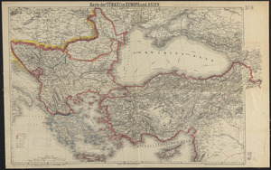
Karte der Türkei in Europa und Asien
Find More Like This >>
Tools
Share
Facebook
Pinterest
X
Reddit
Tumblr
Email
Copy link
Add to Folder
Questions/Comments
Cite This Item
IIIF Manifest
Downloads
Primary (full resolution, uncompressed)
(TIF, 111 MB)
Large (full resolution)
(JPEG, 9.35 MB)
Medium
(JPEG, 243 KB)