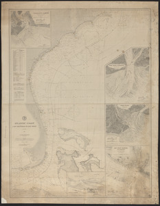
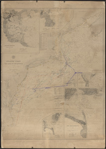
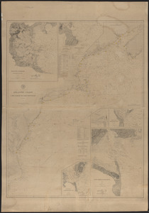
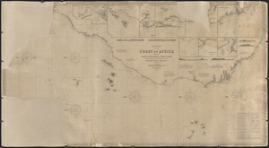
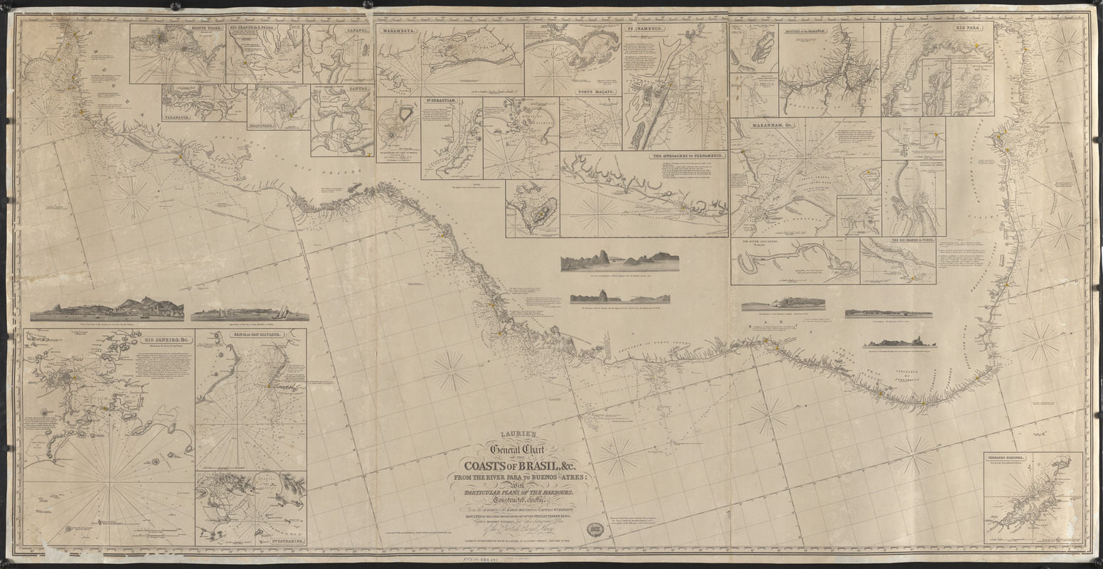
Laurie's general chart of the coasts of Brasil, &c. from the River Para to Buenos Ayres with particular plans of the harbours
Item Information
- Title:
- Laurie's general chart of the coasts of Brasil, &c. from the River Para to Buenos Ayres with particular plans of the harbours
- Surveyor:
- Roussin, Albin-Reine, baron, 1781-1854
- Surveyor:
- Hewett, William Nathan Wrighte, Sir, 1834-1888
- Surveyor:
- King, Philip Parker, 1793-1856
- Surveyor:
- Fitzroy, Robert, 1805-1865
- Cartographer:
- Purdy, John, 1773-1843
- Cartographer:
- Findlay, A. (Alexander), 1790-1870
- Engraver:
- Findlay, A. (Alexander), 1790-1870
- Name on Item:
-
Constructed chiefly from the surveys of the Baron Roussin and Captain Wm. Hewett, adjusted by the later observations of Captain Phillip Parker King, Captain Robert Fitzroy, and other distinguished officers of the British Royal Navy ; Constructed and drawn by John Purdy and Alexr. Findlay, Junr. ; Engraved by Alexr. Findlay
- Date:
-
1861
- Format:
-
Maps/Atlases
- Genre:
-
Nautical charts
- Location:
- Atwood Museum of the Chatham Historical Society
- Collection (local):
-
Nautical Chart Collection of the Atwood Museum, Chatham Historical Society
- Subjects:
-
Coastlines
- Places:
-
UruguayMontevideoMontevideo
BrazilSão PauloCananéia
BrazilParanáParanaguá
UruguayMaldonadoMaldonado
BrazilSão PauloSantos
BrazilAlagoasMaceió
BrazilBahiaAbrolhos, Arquipélago dos (archipelago)
BrazilRio de JaneiroFrio, Cabo (cape)
PeruMarañón, Río (river)
BrazilMaranhão
BrazilVolta GrandeSeara
BrazilCearáJaguaribe (river)
BrazilBahiaJaneiro, Rio de (river)
UruguaySorianoSan Salvador (river)
BrazilPernambucoRecife
- Extent:
- 1 map ; 96 x 193 cm
- Permalink:
- https://ark.digitalcommonwealth.org/ark:/50959/5138jp45w
- Terms of Use:
-
No known copyright restrictions.
This work is licensed for use under a Creative Commons Attribution Non-Commercial No Derivatives License (CC BY-NC-ND).