Skip to search
Skip to main content
Digital Commonwealth
Sign Up / Log In
Search for
Search
Search
Search
Basic
Advanced
Explore
Map
Collections
Institutions
Formats
For Educators
Primary Source Sets
Lesson Plans
Using Primary Sources
Searching Digital Commonwealth
For Institutions
Join Digital Commonwealth
Conferences, Trainings, & Events
How to Contribute Collections
Digitization Services
Board & Committees
Frequently Asked Questions
About
About Digital Commonwealth
News & Announcements
Copyright & Terms of Use
Harmful Content Statement
Partners
API
Contact Us
Boston Public Library
Norman B. Leventhal Map Center Collection
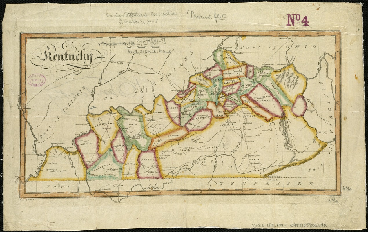
Kentucky
Kentucky
×
Item Information
Title:
Kentucky
Creator:
Melish, John, 1771-1822
Name on Item:
drawn by J. Melish ; J. Vallance sc.
Date:
[1812]
Format:
Maps/Atlases
Location:
Boston Public Library
Norman B. Leventhal Map Center
Collection (local):
Norman B. Leventhal Map Center Collection
Subjects:
Kentucky--Maps
Places:
Kentucky
Extent:
1 map : col. ; 17 x 36 cm.
Permalink:
https://ark.digitalcommonwealth.org/ark:/50959/6t053p562
Terms of Use:
No known copyright restrictions.
No known restrictions on use.
Publisher:
Philadelphia : John Melish
Scale:
Scale [ca. 1:2,000,000]
Language:
English
Notes:
Appears in the author's Travels through the United States of America, in the years 1806 & 1807, and 1809, 1810, & 1811. Philadelphia, 1812.
Relief shown by hachures.
Shows counties, towns, roads and rivers.
Notes (date):
This date is inferred.
Identifier:
06_01_006293
Call #:
G3950 1812 .M45
Barcode:
39999059022192
show more...
View MODS XML
More Like This
Kentuckey
Kentucky and Tennessee
Kentucky and Tennessee
Kentucky, reduced from Elihu Barker's large map
Find More Like This >>
Tools
Share
Facebook
Pinterest
X
Reddit
Tumblr
Email
Copy link
Add to Folder
Questions/Comments
Cite This Item
IIIF Manifest
Downloads
Primary (full resolution, uncompressed)
(TIF, 41.4 MB)
Large (full resolution)
(JPEG, 3.48 MB)
Medium
(JPEG, 384 KB)