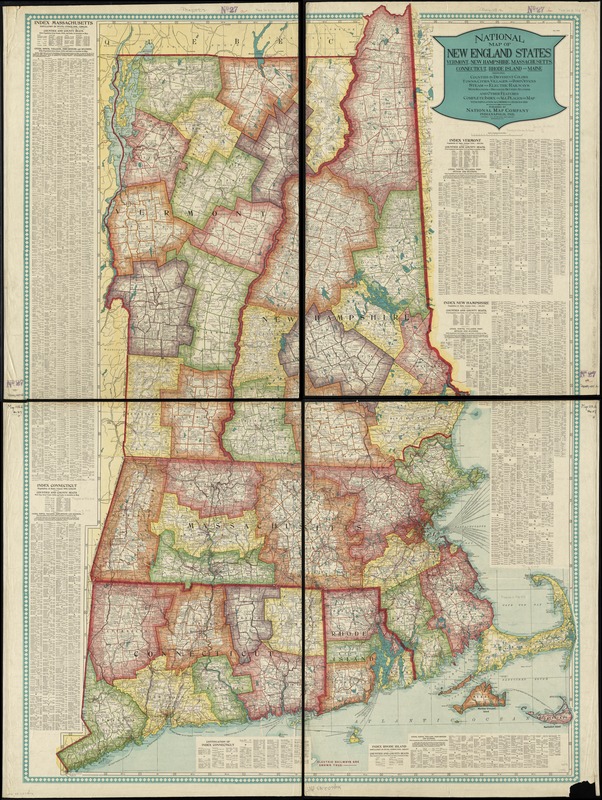
National map of New England states Vermont, New Hampshire, Massachusetts, Connecticut, Rhode Island and Maine showing counties in different colors, towns, cities, villages and post offices, steam and electric railways with stations and distances between stations and other features, complete index to all places on map with population according to census of 1910
National map of New England states Vermont, New Hampshire, Massachusetts, Connecticut, Rhode Island and Maine showing counties in different colors, towns, cities, villages and post offices, steam and electric railways with stations and distances between stations and other features, complete index to all places on map with population according to census of 1910
Item Information
Title:
National map of New England states Vermont, New Hampshire, Massachusetts, Connecticut, Rhode Island and Maine showing counties in different colors, towns, cities, villages and post offices, steam and electric railways with stations and distances between stations and other features, complete index to all places on map with population according to census of 1910
Relief shown by hachures.
Includes indexes with population figures.
Index, postal zone scales, and maps on verso.
Maps on verso: Map showing parcel post unit squares for New England and Middle Atlantic states -- National map of Maine -- Map of the United States and adjacent territory -- Alaska -- Porto Rico -- Philippine Islands -- Hawaii -- Tutuila I. -- Samoa -- Guam -- Wake I. -- Howland I. and Baker I.