Title supplied by cataloger.
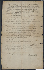
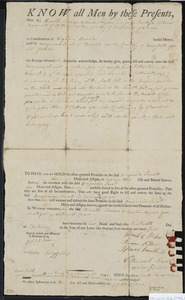
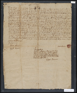
"True copy" of grant from "the court" to the church at New Plymouth and inhabitants of "Nawsett" for lands lying between Billingsgate and Nameskeekett (technically now Orleans); originally in miscellaneous folder.
Additional grants on page: 1646 Governor Bradford: Nawsett granted township status with same rights as others in government, copy examined by "J.C." 1694: lays out boundaries of lands between Yarmouth and Eastham, "bounds of the land bought for the Countrey belonging to Cape Cod," copy examined by "J.C." Message at bottom says "I don't find any thing else about the Grant or bounds of Nawsett nor any Deed of Confirmation from the Goverment on record to sd Town" and "A true copy of a copy Nathaniel Gould"
Finding aid available at: http://www.sturgislibrary.org/pdf/stanley_smith_deed_collection.pdf
Transaction keyword(s): tract of land, lea, Purchaser's Bounds, "Hering" ( and Herring) Brook, Billingsgate, meadows, Bass (?) pond, islands; (from 1694 entry) river, Namskeekett, marked tree, stake, rocky point, Satuckett, lee side, Eastern Harbor, little pond
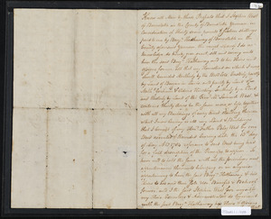
![Deed of property in Eastham (Nameskeekett [Orleans]) sold to Andrew Hallett of Nawsett by Nicholas Simpkins of Yarmouth](https://bpldcassets.blob.core.windows.net/derivatives/images/commonwealth:c247j8166/image_access_800.jpg)