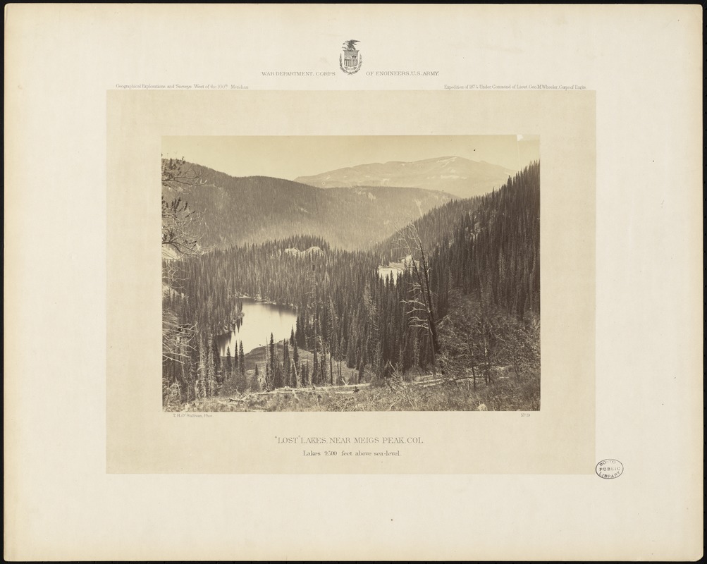
Descriptive legend of view no. 19: The Lost Lakes lie in a secluded spot at the head of the Conejos Cañon, at an approximate height of 10,000 feet above the sea. Crossing the summit between the Conejos and the Alamosa River is a trail which passes very near this lacustrine group, but, on account of their hidden position, affords but a very short glimpse of them. Hence their name, "Lost" Lakes. They are feeders of the Conejos River, which flows into the Rio Grande. They are of considerable size, the one in the foreground being three-fourths of a mile in length. Around them, and upon the neighboring hills, are dense forests of the Douglas pine or spruce, and thickets of aspen. These woods are inhabited by bears, deer, mountain sheep, turkeys, ducks, and other game in great numbers, while farther down the stream an abundance of trout is found. The view before us is characteristic of the beauty of the mountain scenery of Colorado. It represents a portion of the San Juan range, which is here the divide between the Atlantic and Pacific Oceans, and the back-bone of the continent. On the distant peaks there are patches of snow yet remaining; these may be considered perennial, as the photograph was taken in the last days of summer.
Title from item.
On item: War Department, Corps of Engineers, U.S. Army. Geographical Explorations and Surveys. West of the 100th Meridian. Expedition of 1874. Under Command of Lieut. Geo. M. Wheeler, Corps of Engrs.
Plate number: No. 19