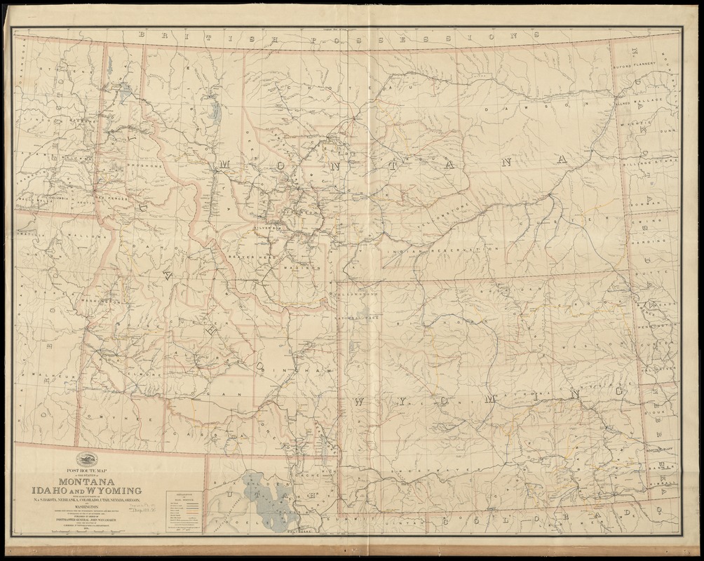
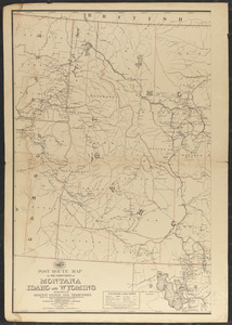
Post route map of the states of Montana, Idaho and Wyoming with adjacent parts of N. & S. Dakota, Nebraska, Colorado, Utah, Nevada, Oregon, and Washington showing post offices with intermediate distances and mail routes in operation on the 1st of October 1891
Post route map of the states of Montana, Idaho and Wyoming with adjacent parts of N. & S. Dakota, Nebraska, Colorado, Utah, Nevada, Oregon, and Washington showing post offices with intermediate distances and mail routes in operation on the 1st of October 1891
Item Information
Title:
Post route map of the states of Montana, Idaho and Wyoming with adjacent parts of N. & S. Dakota, Nebraska, Colorado, Utah, Nevada, Oregon, and Washington showing post offices with intermediate distances and mail routes in operation on the 1st of October 1891
Also shows counties, railroads, postal routes, and frequency of mail service.
Prime meridians: Washington and Greenwich.
"The service on this diagram brought up to date of Oct. 1st. 1891."