Skip to search
Skip to main content
Digital Commonwealth
Sign Up / Log In
Search for
Search
Search
Search
Basic
Advanced
Explore
Map
Collections
Institutions
Formats
For Educators
Primary Source Sets
Lesson Plans
Using Primary Sources
Searching Digital Commonwealth
For Institutions
Join Digital Commonwealth
Conferences, Trainings, & Events
How to Contribute Collections
Digitization Services
Board & Committees
Frequently Asked Questions
About
About Digital Commonwealth
News & Announcements
Copyright & Terms of Use
Harmful Content Statement
Partners
API
Contact Us
Boston Public Library
Norman B. Leventhal Map Center Collection
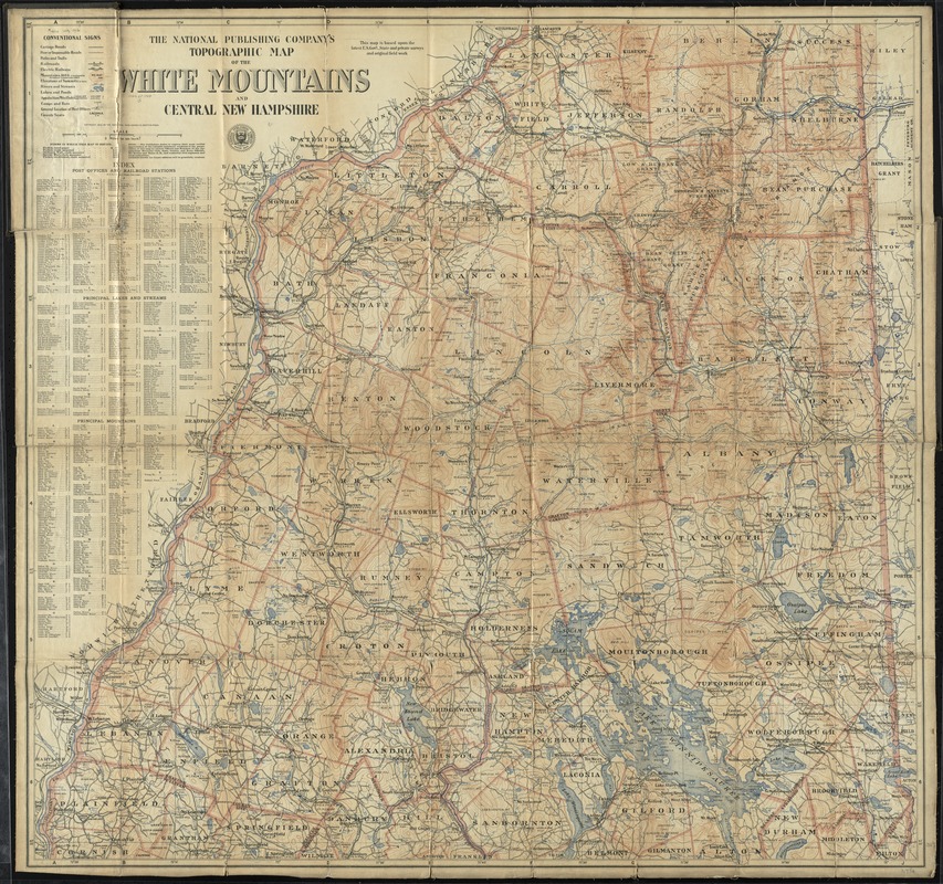
The National Publishing Company's topographic map of the White Mountains and central New Hampshire
The National Publishing Companys topographic map of the White Mountains and central New Hampshire
×
Item Information
Title:
The National Publishing Company's topographic map of the White Mountains and central New Hampshire
Title (alt.):
Topographic map of the White Mountains and central New Hampshire
Creator:
National Publishing Company (Boston, Mass.)
Date:
[ca. 1902]
Format:
Maps/Atlases
Location:
Boston Public Library
Norman B. Leventhal Map Center
Collection (local):
Norman B. Leventhal Map Center Collection
Subjects:
White Mountains (N.H. and Me.)--Maps
New Hampshire--Maps
Places:
White Mountains
Extent:
1 map : col. ; 90 x 95 cm.
Permalink:
https://ark.digitalcommonwealth.org/ark:/50959/cj82kw083
Terms of Use:
No known copyright restrictions.
No known restrictions on use.
Publisher:
Boston : The Company
Scale:
Scale [1:126,720]. 2 miles to an in.
Language:
English
Notes:
This map is based upon the latest U.S. Gov't, state and private surveys and original field work.
Relief shown by contours and spot heights.
Includes index to post offices and railroad stations, principal lakes and streams, and principal mountains.
Identifier:
06_01_009820
Call #:
G3742.W52C2 1902 .N38
Barcode:
39999065709337
show more...
View MODS XML
More Like This
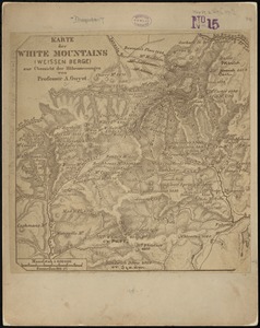
Karte der White Mountains (Weissen Berge) zur übersicht der ...
Leavitt's map with views of the White Mountains, New Hampshire : 1859
Maine Central Railroad : through the White Mountains
Map of the White Mountains, N.H
Find More Like This >>
Tools
Share
Facebook
Pinterest
X
Reddit
Tumblr
Email
Copy link
Add to Folder
Questions/Comments
Cite This Item
IIIF Manifest
Downloads
Primary (full resolution, uncompressed)
(TIF, 344 MB)
Large (full resolution)
(JPEG, 28.9 MB)
Medium
(JPEG, 362 KB)