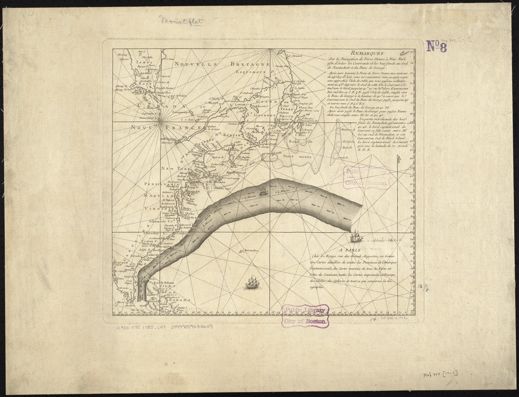
Remarques sur la navigation de terre-neuve à New-York afin d'eviter les courrants et les bas-fonds au sud de Nantuckett et du Banc de George
Remarques sur la navigation de terre-neuve à New-York afin deviter les courrants et les bas-fonds au sud de Nantuckett et du Banc de George
Item Information
Title:
Remarques sur la navigation de terre-neuve à New-York afin d'eviter les courrants et les bas-fonds au sud de Nantuckett et du Banc de George
Description:
One of the preferred routes that captains and navigators sailing from America to England learned to use was the Gulf Stream, a strong, warm current that flows north along the Atlantic coast and then east toward Europe. Initially charted by Benjamin Franklin in 1768, this discovery helped ships minimize travel time across the ocean, speeding up the transatlantic voyage for travelers, merchants, and goods. Franklin purchased this 1785 chart, a French adaptation of his original findings, when he served in Paris as a diplomat for the United States during the early years of the republic.
Based on Timothy Folger's original annotations ... It would appear that [Benjamin] Franklin added little or nothing beyond the red lines which indicated the portion to be reproduced ...--De Vorsey, L. Pioneer charting of the Gulf Stream, in Imago mundi, 28 (1976), p. 107.
Cataloging, conservation, and digitization made possible in part by The National Endowment for the Humanities: Exploring the human endeavor.