Skip to search
Skip to main content
Digital Commonwealth
Sign Up / Log In
Search for
Search
Search
Search
Basic
Advanced
Explore
Map
Collections
Institutions
Formats
For Educators
Primary Source Sets
Lesson Plans
Using Primary Sources
Searching Digital Commonwealth
For Institutions
Join Digital Commonwealth
Conferences, Trainings, & Events
How to Contribute Collections
Digitization Services
Board & Committees
Frequently Asked Questions
About
About Digital Commonwealth
News & Announcements
Copyright & Terms of Use
Harmful Content Statement
Partners
API
Contact Us
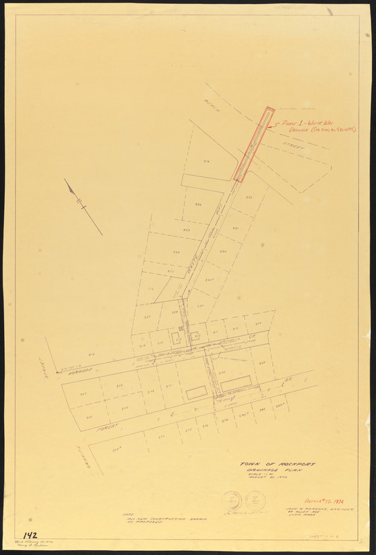
Town of Rockport
Rockport Town Clerk, Street, Roads and Maps
Town of Rockport drainage plan
Town of Rockport drainage plan
×
Item Information
Title:
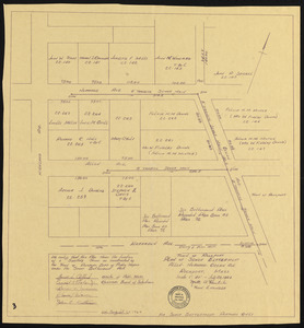
Town of Rockport drainage plan
Name on Item:
John W. Parsons, engineer, 44 Allen Ave., Lynn, Mass.
Date:
August 30, 1973
Format:
Maps/Atlases
Genre:
Planning drawings
Location:
Town of Rockport
Collection (local):
Streets, Roads and Maps of Rockport, MA 1823-1974 (approximate)
Subjects:
Sewers
Places:
Massachusetts
>
Essex (county)
>
Rockport
Extent:
1 map ; 88 x 58 cm
Permalink:
https://ark.digitalcommonwealth.org/ark:/50959/dz010x67f
Terms of Use:
Rights status not evaluated.
No known restrictions on use.
Scale:
Scale 1:480
Language:
English
Notes:
Title from item.
Notes (date):
Date from item.
Identifier:
142
PF-6-2
show more...
View MODS XML
More Like This
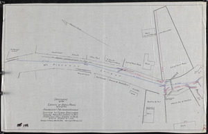
Drainage of the estate of Amos Rowe and of the adjacent ...
Drainage of the estate of Amos Rowe and the adjacent neighborhood
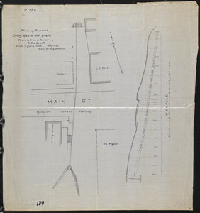
Plan of proposed catch basin and drain from L. Grimes Corner to ...
Plan of sewer betterment, Allen, Norwood, Ocean Ave., Rockport, Mass.
Find More Like This >>
Tools
Share
Facebook
Pinterest
X
Reddit
Tumblr
Email
Copy link
Add to Folder
Questions/Comments
Cite This Item
Downloads
Primary (full resolution, uncompressed)
(TIF, 122 MB)
Large (full resolution)
(JPEG, 10.3 MB)
Medium
(JPEG, 101 KB)