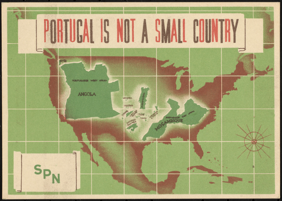
Postcard depicting Portugal and its colonies superimposed over a map of the United States to compare land area.
Verso: Text comparing area of Portugal to United States and European countries, and extolling contributions of Portugal to the world.
Notes (date):
This date is inferred.
Notes (exhibitions):
Exhibited: "Bending lines: maps and data from distortion to deception," organized by the Norman B. Leventhal Map & Education Center at the Boston Public Library, 2020-2021.