Skip to search
Skip to main content
Digital Commonwealth
Sign Up / Log In
Search for
Search
Search
Search
Basic
Advanced
Explore
Map
Collections
Institutions
Formats
For Educators
Primary Source Sets
Lesson Plans
Using Primary Sources
Searching Digital Commonwealth
For Institutions
Join Digital Commonwealth
Conferences, Trainings, & Events
How to Contribute Collections
Digitization Services
Board & Committees
Frequently Asked Questions
About
About Digital Commonwealth
News & Announcements
Copyright & Terms of Use
Harmful Content Statement
Partners
API
Contact Us
Boston Public Library
Norman B. Leventhal Map Center Collection
Mittel- und Nord-Africa, westl. theil
Mittel- und Nord-Africa, westl. theil
×
Item Information
Title:
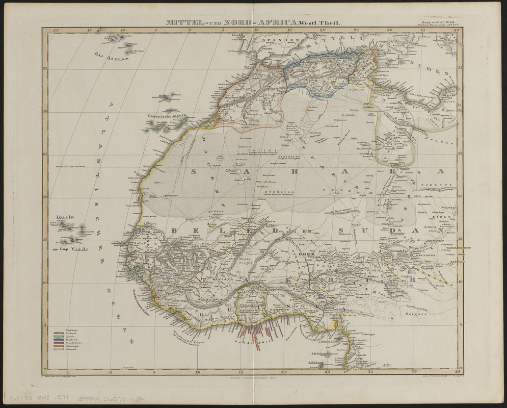
Mittel- und Nord-Africa, westl. theil
Title (alt.):
Mittel- und Nord-Africa, westlicher theil
Cartographer:
Stülpnagel, F. von
Engraver:
Behrens, W.
Publisher:
Justus Perthes (Firm : Gotha, Germany)
Name on Item:
entw. u. gez. v. Fr. v. Stülpnagel ; gest. v. W. Behrens ; schrift v. F.I. Baumgarten
Date:
1848
Format:
Maps/Atlases
Location:
Boston Public Library
Norman B. Leventhal Map Center
Collection (local):
Norman B. Leventhal Map Center Collection
Subjects:
Africa, West--Maps
Africa, North--Maps
Places:
West Africa
(area)
North Africa
(area)
Extent:
1 map : hand color ; 32 x 38 cm
Permalink:
https://ark.digitalcommonwealth.org/ark:/50959/ht250c299
Terms of Use:
No known copyright restrictions.
No known restrictions on use.
Publisher:
[Gotha] : [Justus Perthes]
Scale:
Scale approximately 1:14,200,000
Language:
German
Notes:
Indicates colonial possessions.
Relief shown by hachures.
Prime meridian: [Ferro].
"Ausg. in 63 bl. no. LII. Stielers' Hand-Atlas (No. 45a)."
Identifier:
06_01_014622
Call #:
G8735 1848 .S78
Barcode:
39999065704684
show more...
View MODS XML
More Like This
A chart of the western coast of Africa, from the Straits of ...
Northwest Africa
Partie occidentale de l'ancien continent depuis Lisbonne jusquà ...
Eastern Mediterranean
Find More Like This >>
Tools
Share
Facebook
Pinterest
X
Reddit
Tumblr
Email
Copy link
Add to Folder
Questions/Comments
Cite This Item
IIIF Manifest
Downloads
Primary (full resolution, uncompressed)
(TIF, 71.9 MB)
Large (full resolution)
(JPEG, 6.04 MB)
Medium
(JPEG, 291 KB)
GeoTIFF (georeferenced)
(TIF, 69.3 MB)