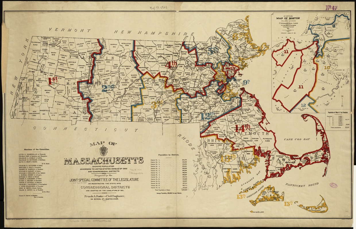
Map of Massachusetts showing population according to United States Census of 1900 and congressional districts
Map of Massachusetts showing population according to United States Census of 1900 and congressional districts
Item Information
Title:
Map of Massachusetts showing population according to United States Census of 1900 and congressional districts
Description:
In 1900, Massachusetts had 13 Congressional Districts. After the 1900 census, it needed to add another and this map shows the new boundaries. Districts were drawn to encompass adjacent areas when possible, but as the site of the original gerrymander, eastern Massachusetts has long had oddly shaped voting districts. The expansion of Boston in the late 19th century to incorporate Allston and Brighton also resulted in non-adjacent areas being included in the same district as the inset map of the 11th indicates. Population figures for towns within districts help viewers understand the link between geographic area and population density.
Includes list of committee members.
Inset: An outline map of Boston showing the ward lines, also the congressional lines.
"Wright & Potter Printing Co."
"Forbes Co."
Notes (date):
This date is inferred.
Notes (exhibitions):
Exhibited: "America Votes: Mapping the Political Landscape" organized by the Norman B. Leventhal Map Center at the Boston Public Library, 2012.