Entered according to Act of Congress in the year 1861 by J.H. Colton.
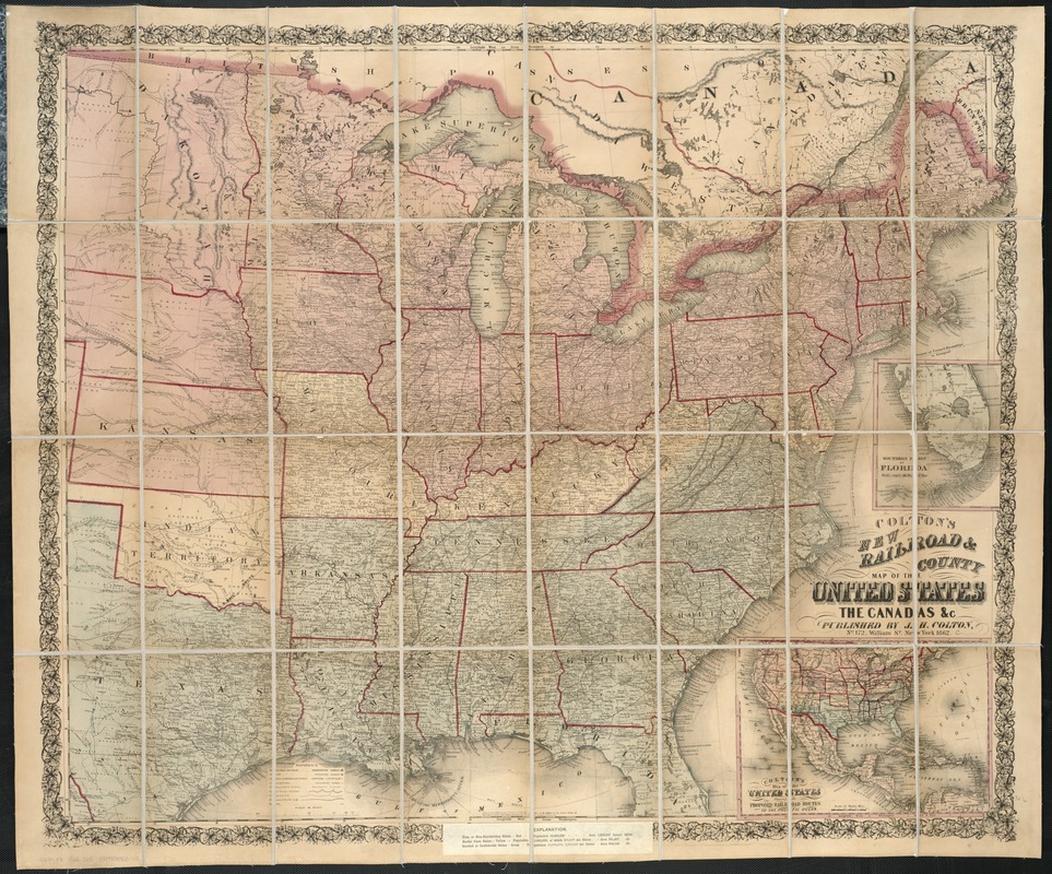
"Explanations" (i.e., legend) is pasted over the bottom margin. Map is colored to show "free, or non-slaveholding states" (pink), "border slave states" (yellow), and "seceded or confederate states" (green).
Inset: Colton's map of the United States showing the proposed railroad routes to the Pacific Ocean. 19 x 26 cm.
Advertisement for "Bacon's shilling war maps" is pasted onto the verso.
Description derived from published bibliography.