Skip to search
Skip to main content
Digital Commonwealth
Sign Up / Log In
Search for
Search
Search
Search
Basic
Advanced
Explore
Map
Collections
Institutions
Formats
For Educators
Primary Source Sets
Lesson Plans
Using Primary Sources
Searching Digital Commonwealth
For Institutions
Join Digital Commonwealth
Conferences, Trainings, & Events
How to Contribute Collections
Digitization Services
Board & Committees
Frequently Asked Questions
About
About Digital Commonwealth
News & Announcements
Copyright & Terms of Use
Harmful Content Statement
Partners
API
Contact Us
Boston Public Library
Norman B. Leventhal Map Center Collection
/
Urban Maps (Collection of Distinction)
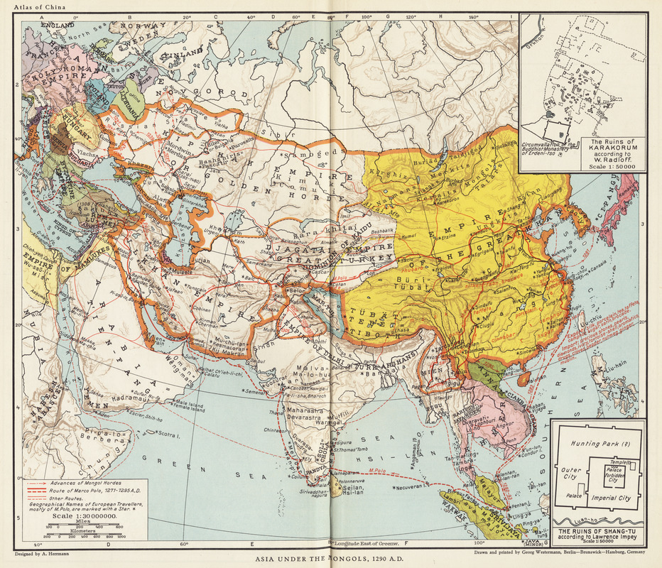
Asia under the Mongols, 1290 A.D.
Asia under the Mongols, 1290 A.D.
×
Item Information
Title:
Asia under the Mongols, 1290 A.D.
Cartographer:
Herrmann, Albert, 1886-1945
Date:
1935
Format:
Maps/Atlases
Location:
Boston Public Library
Norman B. Leventhal Map Center
Collection (local):
Norman B. Leventhal Map Center Collection
Subjects:
China--Historical geography--Maps
Places:
China
Extent:
1 map : color ; 29 x 34 cm
Permalink:
https://ark.digitalcommonwealth.org/ark:/50959/q524n190g
Terms of Use:
Copyright (c) Harvard University Press.
All rights reserved.
Publisher:
Cambridge [Mass.] : Harvard University Press
Scale:
Scale 1:30,000,000
Language:
English
Notes:
From Historical and commercial atlas of China.
Identifier:
06_01_004262
Call #:
G2305 .H4 1935
Barcode:
39999059005395
show more...
View MODS XML
More Like This
Asia, ca. 100 A.D.
The beginnings of ancient China, 1900-1300 B.C.
The contending states - boundaries of 350 B.C.
Foreign religions in Central Asia and China up to the 14th century ...
Find More Like This >>
Tools
Share
Facebook
Pinterest
X
Reddit
Tumblr
Email
Copy link
Add to Folder
Questions/Comments
Cite This Item
IIIF Manifest