Skip to search
Skip to main content
Digital Commonwealth
Sign Up / Log In
Search for
Search
Search
Search
Basic
Advanced
Explore
Map
Collections
Institutions
Formats
For Educators
Primary Source Sets
Lesson Plans
Using Primary Sources
Searching Digital Commonwealth
For Institutions
Join Digital Commonwealth
Conferences, Trainings, & Events
How to Contribute Collections
Digitization Services
Board & Committees
Frequently Asked Questions
About
About Digital Commonwealth
News & Announcements
Copyright & Terms of Use
Harmful Content Statement
Partners
API
Contact Us
Boston Public Library
Norman B. Leventhal Map Center Collection
The pictorial map, United States stamps
The pictorial map, United States stamps
×
Item Information
Title:
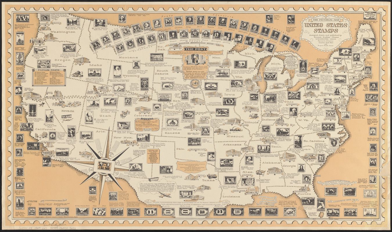
The pictorial map, United States stamps
Title (alt.):
United States stamps
Creator:
Chase, Ernest Dudley, 1878-
Artist:
Chase, Ernest Dudley, 1878-
Cartographer:
Chase, Ernest Dudley, 1878-
Publisher:
Chase, Ernest Dudley, 1878-
Researcher:
Jones, Rupert Frank
Researcher:
Kerr, Charles Peck
Name on Item:
designed, drawn, and published by Ernest Dudley Chase ; research directors, Charles Peck Kerr and Rupert Frank Jones
Date:
[1949]
Format:
Maps/Atlases
Location:
Boston Public Library
Norman B. Leventhal Map Center
Collection (local):
Norman B. Leventhal Map Center Collection
Subjects:
Stamp collecting--United States--Maps
United States--Maps
Pictorial maps
Places:
Extent:
1 map : color ; 48 x 87 cm
Permalink:
https://ark.digitalcommonwealth.org/ark:/50959/q524n3737
Terms of Use:
No known copyright restrictions.
No known restrictions on use.
Publisher:
Winchester, Massachusetts : Ernest Dudley Chase
Scale:
Scale approximately 1:5,300,000
Language:
English
Notes:
Conservation of this piece was funded by Maureen O'Donnell in honor of Eugene E. O'Donnell.
Includes list of "Postage firsts" and historical notes.
Notes (date):
This date is inferred.
Identifier:
06_01_014730
Call #:
G3701.P8 1949 .C43
Barcode:
39999065705673
show more...
View MODS XML
More Like This
The pictorial map, stamps of America
The pictorial map, stamps of the U.S.A.
19th annual convention of the National Association of Real Estate ...
PWA rebuilds the nation
Find More Like This >>
Tools
Share
Facebook
Pinterest
X
Reddit
Tumblr
Email
Copy link
Add to Folder
Questions/Comments
Cite This Item
IIIF Manifest
Downloads
Primary (full resolution, uncompressed)
(TIF, 128 MB)
Large (full resolution)
(JPEG, 10.8 MB)
Medium
(JPEG, 570 KB)