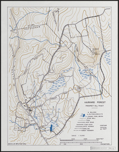
Timing of Old Field Abandonment and Early Logging on Prospect Hill
Item Information
- Title:
- Timing of Old Field Abandonment and Early Logging on Prospect Hill
- Description:
-
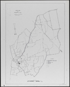
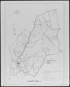
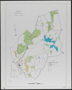
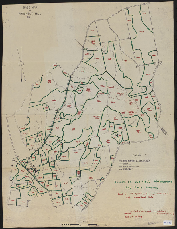
Base Map of Prospect Hill 1951 Timing of Old Field Abandonment and Early Logging based on HF operations records. student reports and unpublished notes
- Creator:
- Foster, David R., 1954-
- Date:
-
1907–2014
- Format:
-
Maps/Atlases
- Location:
-
Harvard University
Harvard Forest Archives
Stack # 1; Drawer # 2 (shelf locator) - Collection (local):
-
The Harvard Forest Map Collection
- Subjects:
-
Boundaries
Land use
1900–1950
- Places:
-
MassachusettsWorcester (county)Prospect Hill (peak)
MassachusettsWorcester (county)Petersham
Prospect Hill Tract
- Extent:
- 1 map : colored map ; 19.5 x 25.5 in.
- Permalink:
- https://ark.digitalcommonwealth.org/ark:/50959/qv33t2028
- Terms of Use:
-
Copyright (c) President and Fellows of Harvard College, Harvard Forest Archives
This work is licensed for use under a Creative Commons Attribution Non-Commercial No Derivatives License (CC BY-NC-ND).