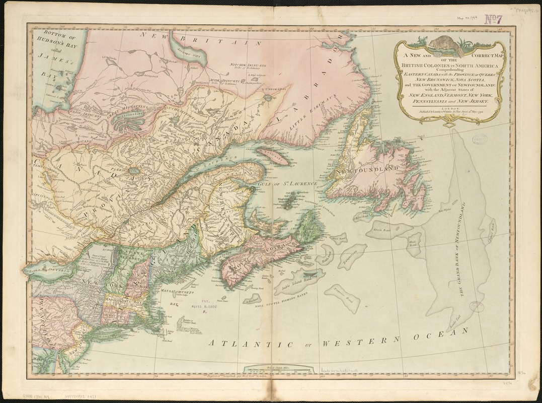
A New and correct map of the British colonies in North America comprehending eastern Canada with the province of Quebec, New Brunswick, Nova Scotia, and the Government of Newfoundland : with the adjacent states of New England, Vermont, New York, Pennsylvania and New Jersey
A New and correct map of the British colonies in North America comprehending eastern Canada with the province of Quebec, New Brunswick, Nova Scotia, and the Government of Newfoundland
Item Information
Title:
A New and correct map of the British colonies in North America comprehending eastern Canada with the province of Quebec, New Brunswick, Nova Scotia, and the Government of Newfoundland : with the adjacent states of New England, Vermont, New York, Pennsylvania and New Jersey
Relief shown pictorially.
Shows boundaries of states.
Appears in Laurie & Whittle's New and elegant imperial sheet atlas, 1800.
Prime meridian: London.
Includes historical notes.
Cataloging, conservation, and digitization made possible in part by The National Endowment for the Humanities: Exploring the human endeavor.