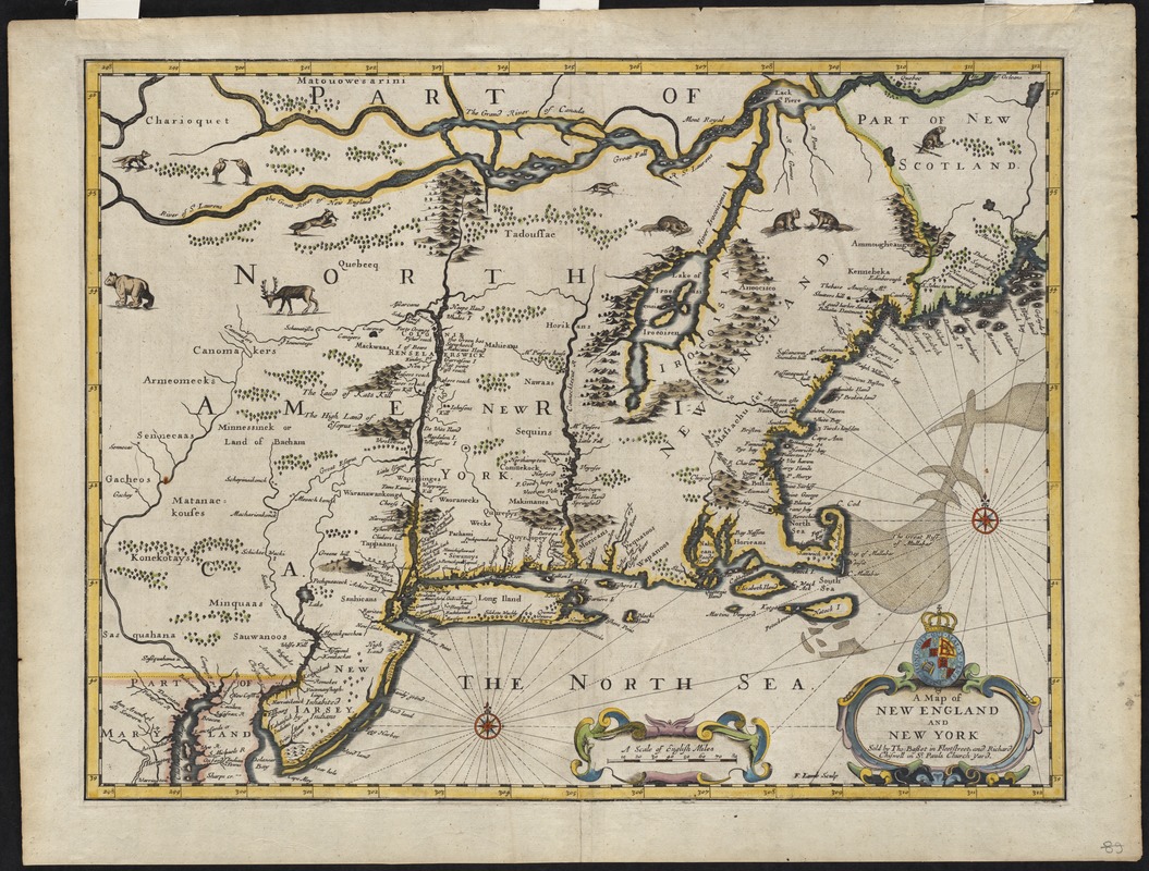
A map of New England and New York
Item Information
- Title:
- A map of New England and New York
- Description:
-
This beautifully engraved and colored map represents an English version of the Jansson-Visscher series of maps of northeastern North America. Since it was published shortly after the expulsion of the Dutch from New York, the map displays geographical features similar to those found on its Dutch counterparts. However, the place names New Netherlands and New Amsterdam have been rechristened New York reflecting British control of the former Dutch colony. This map appeared in Thomas Basset and Richard Chiswell's 1676 edition of John Speed's world atlas, first published in 1627.
- Creator:
- Speed, John, 1552?-1629
- Name on Item:
-
F. Lamb sculp.
- Date:
-
[1676]
- Format:
-
Maps/Atlases
- Location:
- Private Collection
- Collection (local):
-
Mapping Boston Collection
- Subjects:
-
New England--Maps--Early works to 1800
New York (State)--Maps--Early works to 1800
- Places:
-
New England (area)
New York
- Extent:
- 1 map: col. ; 36 x 48 cm.
- Permalink:
- https://ark.digitalcommonwealth.org/ark:/50959/x633fb303
- Terms of Use:
-
No known copyright restrictions.
This work is licensed for use under a Creative Commons Attribution Non-Commercial Share Alike License (CC BY-NC-SA).


