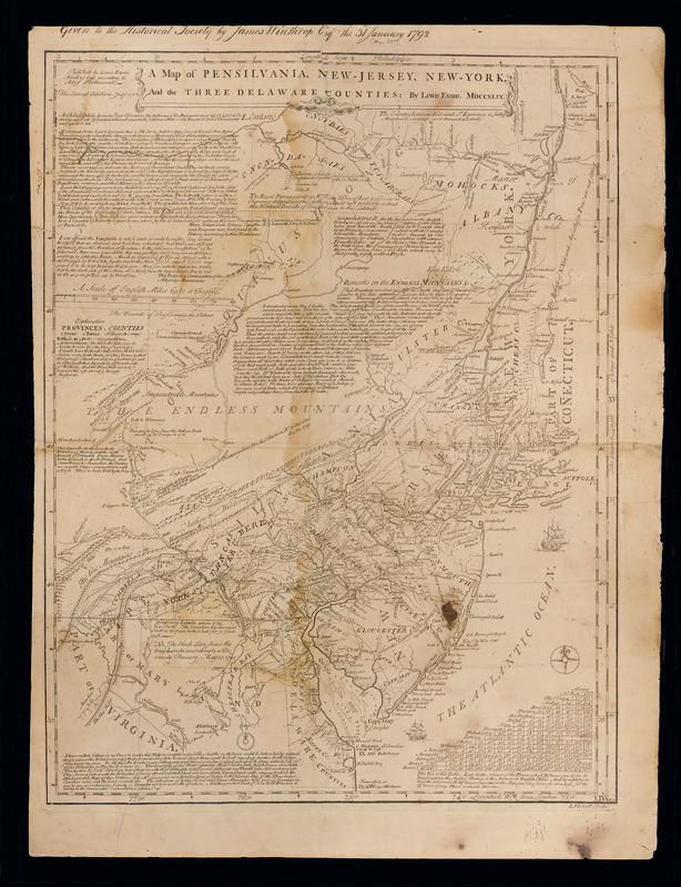
A map of Pensilvania, New-Jersey, New-York, and the three Delaware counties
Item Information
- Title:
- A map of Pensilvania, New-Jersey, New-York, and the three Delaware counties
- Creator:
- Evans, Lewis, 1700?-1756
- Contributor:
- Hebert, L.
- Name on Item:
-
by Lewis Evans ; L. Hebert, sculpt.
- Date:
-
[1752]
- Format:
-
Maps/Atlases
- Location:
- Massachusetts Historical Society
- Collection (local):
-
Massachusetts Historical Society Collection
- Subjects:
-
Middle Atlantic States--Maps--Early works to 1800
- Places:
-
Middle Atlantic (area)
- Extent:
- 1 map ; 65 x 49 cm on sheet 71 x 56 cm.
- Permalink:
- https://ark.digitalcommonwealth.org/ark:/50959/z603vm53v
- Terms of Use:
-
No known copyright restrictions.
This work is licensed for use under a Creative Commons Attribution Non-Commercial Share Alike License (CC BY-NC-SA).


Downloads